Detection Class: Building Footprints
Overview
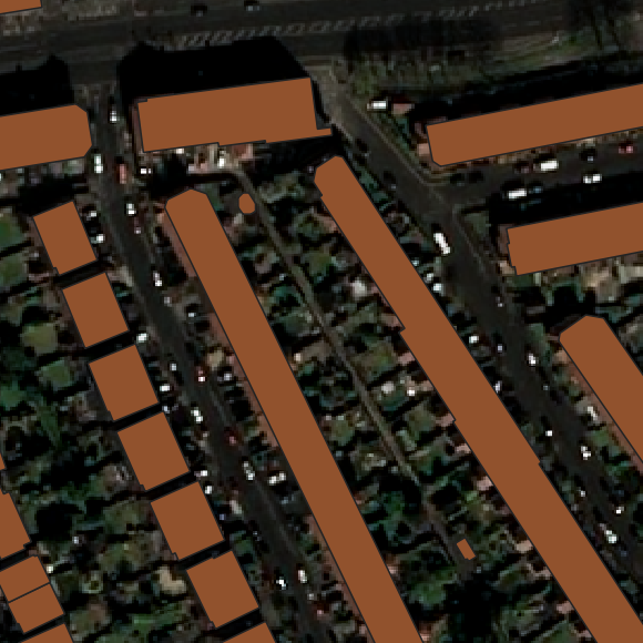
Model BSHRK-W-BFD-11 is trained to detect the footprint of buildings. BSHRK-W-BFD-11 is capable of detecting buildings from aerial image input and producing a high-quality probability heatmap of buildings. The image can then be vectorized for an accurate representation of building footprints.
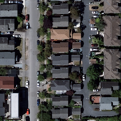
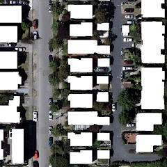
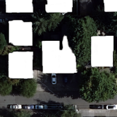
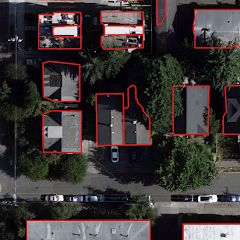
| Imagery | Inference | Vectorization |
|---|---|---|
 |
 |
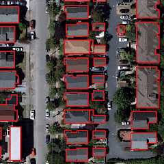 |
| Input imagery by Vexcel Imaging GmbH |
Input and Expected Output
Input
Input data should be a single aerial or satellite image in GeoTIFF or COG file format. Orca containers are trained for detection on orthophoto images with a resolution of 40-60cm and input images should comply with this standard. Detection requires traditional RGB optical channels. For more information on input requirements:
Output
When the above input specifications are met, BSHRK-W-BFD-11 will produce an image mask as a GeoTIFF file with a resolution matching that of the input imagery.
As desired the output can be configured to display either a grayscale probability heatmap of detected building footprints or vectorized data outlining detected footprints. For more information on configuration see Orca Usage.
For output troubleshooting and limitations, see Known Issues and Limitations below.
Accuracy
| Zoning | Accuracy | Balanced Accuracy | IoU |
|---|---|---|---|
| Global | 86% | 85% | 67% |
| CBD* | 76% | 76% | 60% |
| Commercial | 96% | 96% | 92% |
| Residential | 91% | 88% | 80% |
| Rural | 98% | 90% | 86% |
| *Central Business District |
The accuracy and balanced accuracy values displayed above are derived from averages of randomized sample areas in and around a major U.S. metropolitan area. They represent accuracy metrics for Orca building footprint detection as compared to ground truth rounded to the nearest percentage point. The metrics above represent detection and segmentation, but do not represent accuracy metrics for vectorized footprints.
Intersection over union (IoU) represents the degree to which the placement of accurately detected features corresponds to ground truth.
To determine these metrics in respect to ground truth the selected areas are labeled. Importantly, the areas are not included in the labeled datasets used to train the Orca models. The results for the selected ares can then be referenced against the labels.
Known Issues and Limitations
Training
Orca will perform well with imagery in areas with characteristics similar to the images used to train the machine learning algorithms (typically from North America, Europe, and Australia). Unfortunately, it is not possible to tell how performance is impacted with images from other image providers or regions with dissimilar vegetation/color/building characteristics, etc.
Imagery
The quality of the results depends strongly on the quality of the input image.
considerations for input images include: the angle of the input image (the input image needs to be taken from an ortho-projection, not off-nadir); weather conditions (like clouds, fog, snow etc.) or extreme situations (smoke, shadows, etc.); and strongly cohesive building blocks may not be recognized as separate units. Additionally, false positives and negatives are possible when imagery resemblance to buildings is unclear.
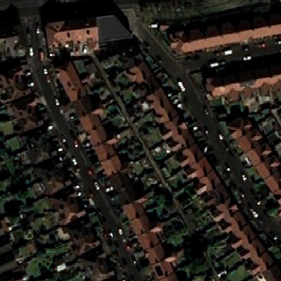
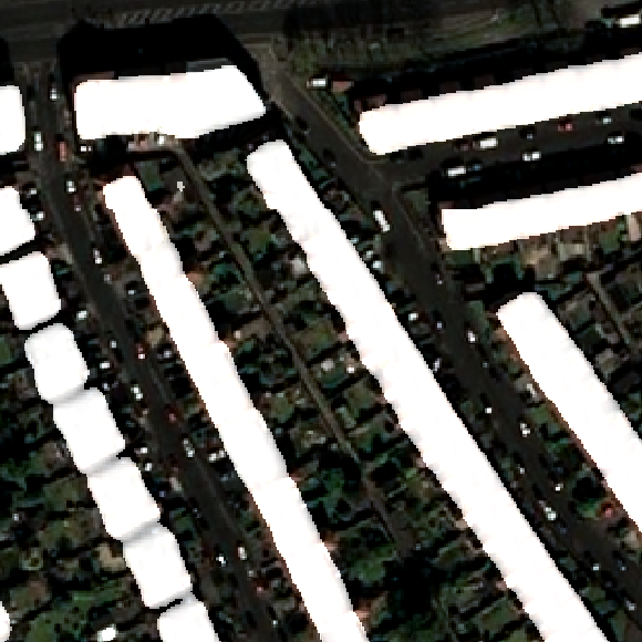
| Imagery | Inference | Vectorization |
|---|---|---|
 |
 |
 |
| Input imagery by Vexcel Imaging GmbH |
| Imagery | Inference | Vectorization |
|---|---|---|
 |
 |
 |
| Input imagery by Airbus Pléiades via UP42.com |
Processes
During polygon simplification some irregularities can occur. Small round objects may be rendered as an object with four right angles. Some footprints that cannot be regularized may have irregular edges. Polygons below 10m2 will be discarded. Therefore it may be occasionally necessary to check the validity of vectorized output using standard GIS tools and software. See Polygon creation and simplification for more info.